I’m getting to grips with my new HTC Desire smartphone.
 There is a brilliant little widget you can get called GPS2GoogleEarth – what it does is use the phone’s GPS sensor to record your journey (or you can use phone masts, though this isn’t as accurate), which you then save.
 When you open the saved file in Google Earth it draws your route on to a map – which you can zoom into as far as Google Earth will allow.
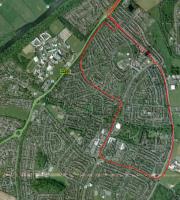
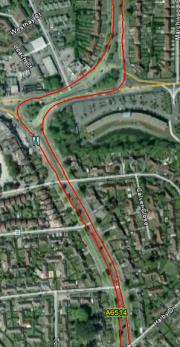
I set it running this morning when I went out on a lesson. The first picture here is a fairly high level view of the part of the lesson which went into Clifton, Nottingham (the red line, obviously). The second is my journey up the ring road (to pick the pupil up) and back again (during the lesson). Note the clear lane separation.
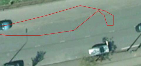
The final picture is where I did a turn in the road outside the pupils house – it’s only when you go down to the highest level of detail that any small inconsistencies in positioning data become clear. I would say that it is accurate to within about 2 metres. At this level of detail, the car sometimes appears to weave across roundabouts or – as you can see here – doesn’t show how close to the kerb I actually got when doing the turn (though I suspect Google’s maps have some margin of error)

You can begin to imagine how useful this could be – to a driving instructor especially.